Share Facebook Twitter LinkedIn Pinterest Bluesky Threads I made maps of the United States transmission grid – details in comments Source: hi-mom-geospatial
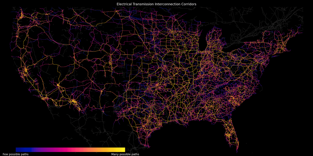
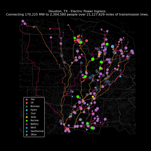
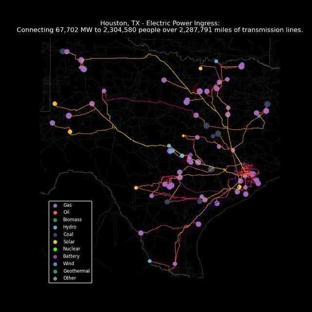
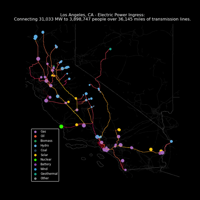
hi-mom-geospatial on August 24, 2024 4:35 pm I used OpenStreetMap and postgis to identify interconnection points on the US electric grid and route paths from power plants to cities. Check out more maps and info on my process here: [Neon Spaghetti (arcgis.com)](https://storymaps.arcgis.com/stories/b872cdf09d03466a88f2dd326ed82c43)

2 Comments
I used OpenStreetMap and postgis to identify interconnection points on the US electric grid and route paths from power plants to cities. Check out more maps and info on my process here:
[Neon Spaghetti (arcgis.com)](https://storymaps.arcgis.com/stories/b872cdf09d03466a88f2dd326ed82c43)
Nice work!