
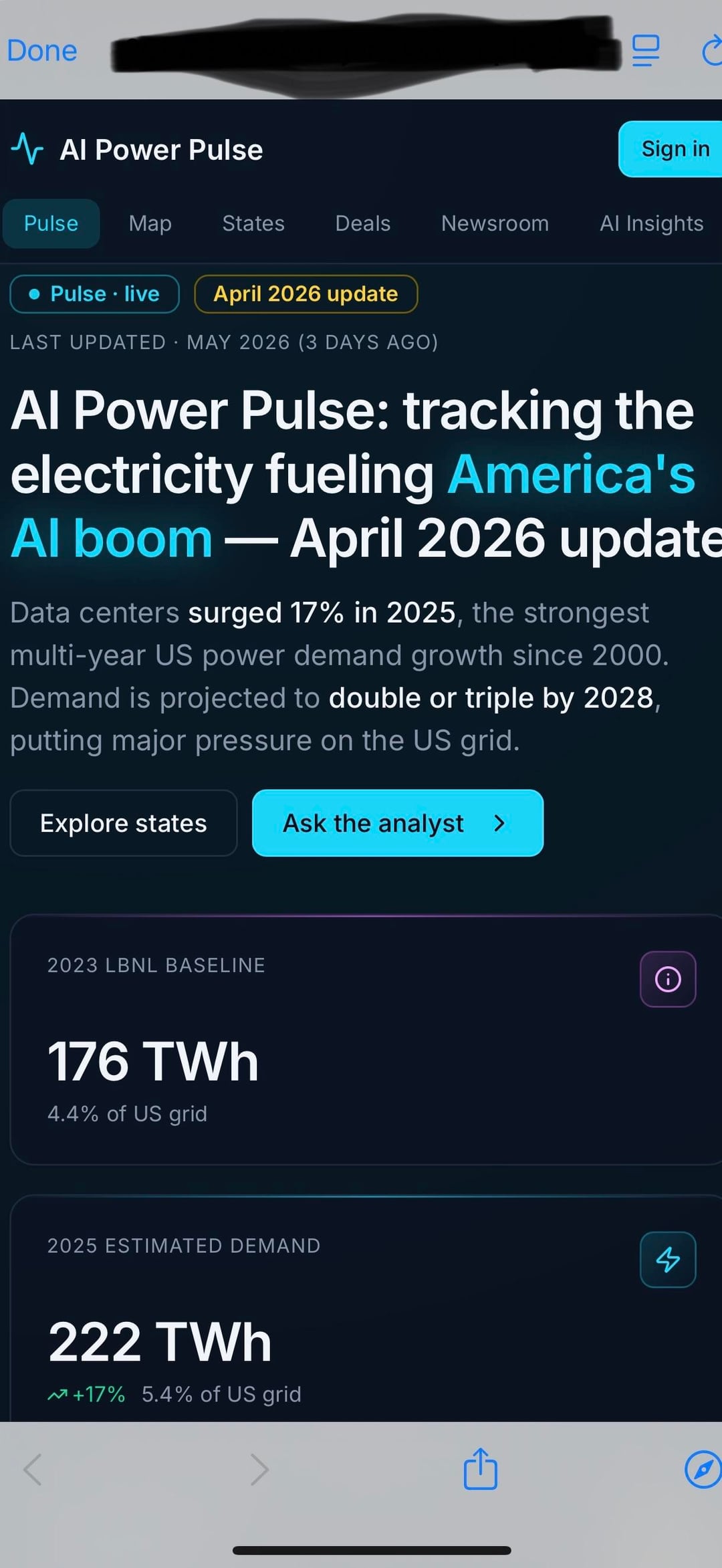
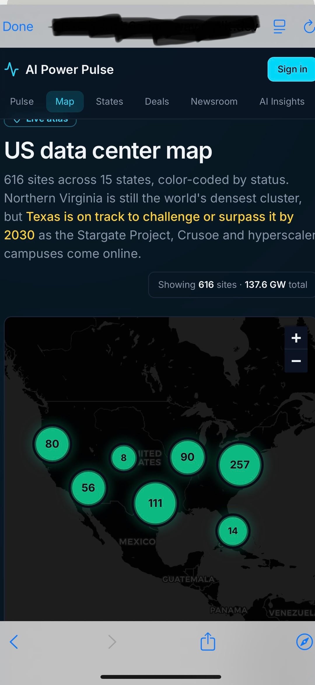
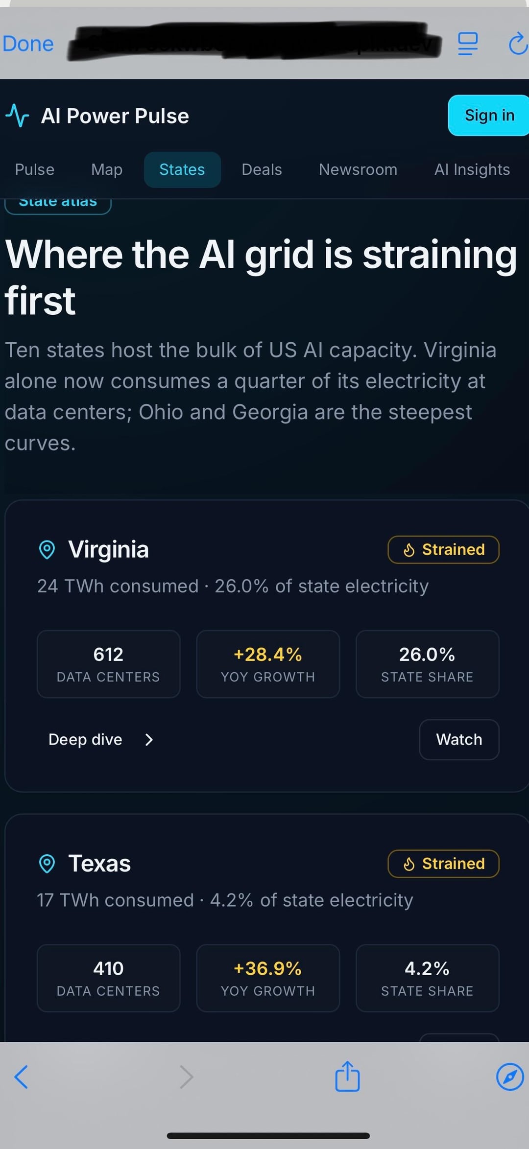
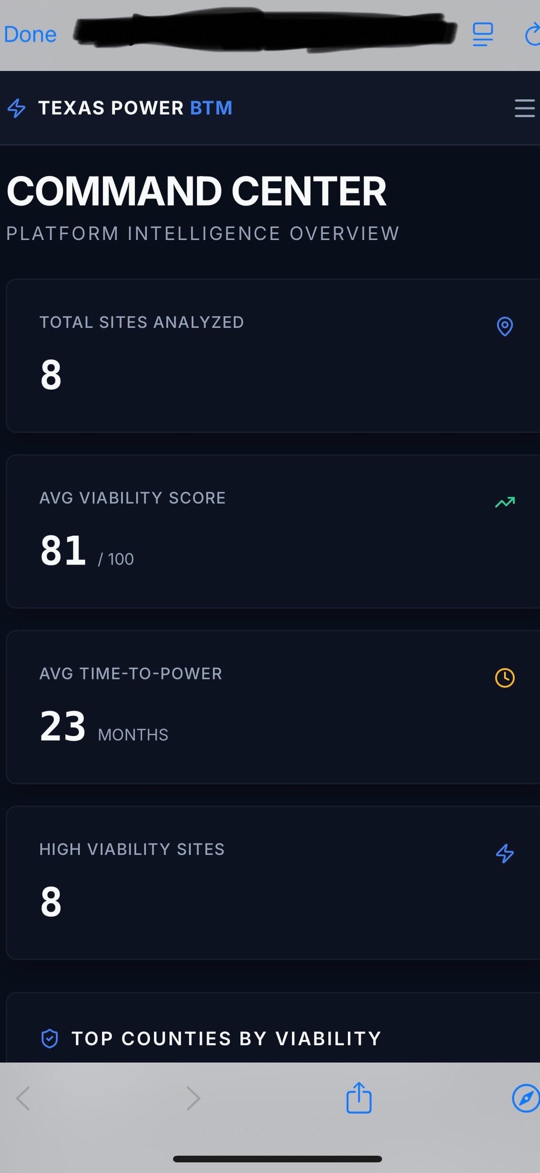
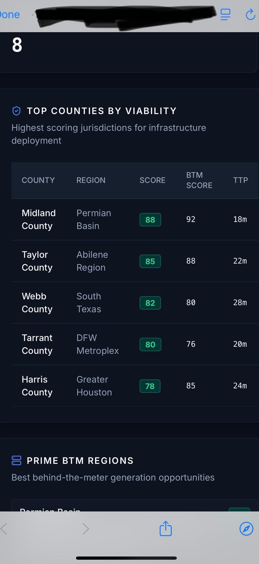
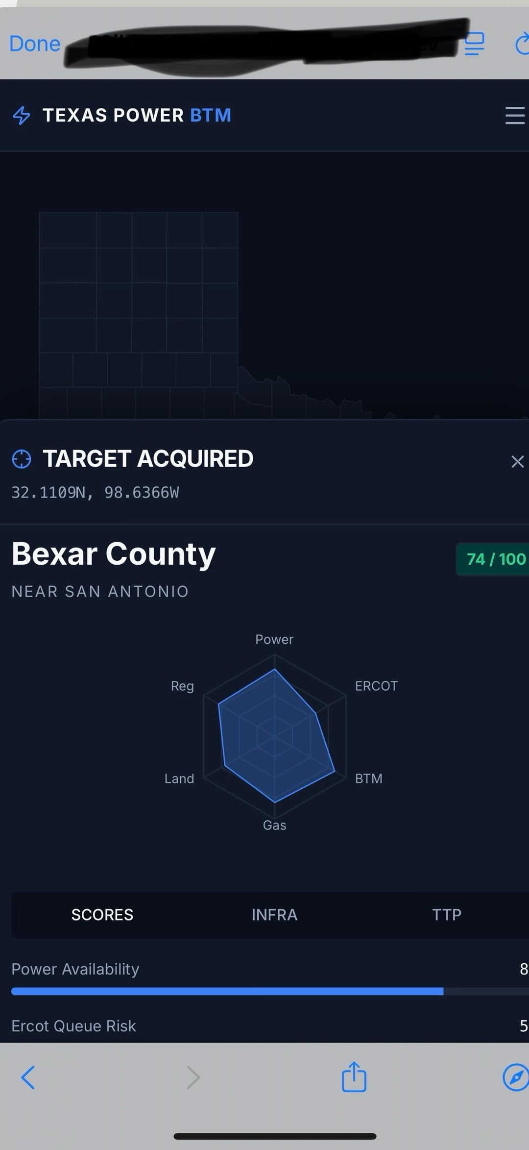
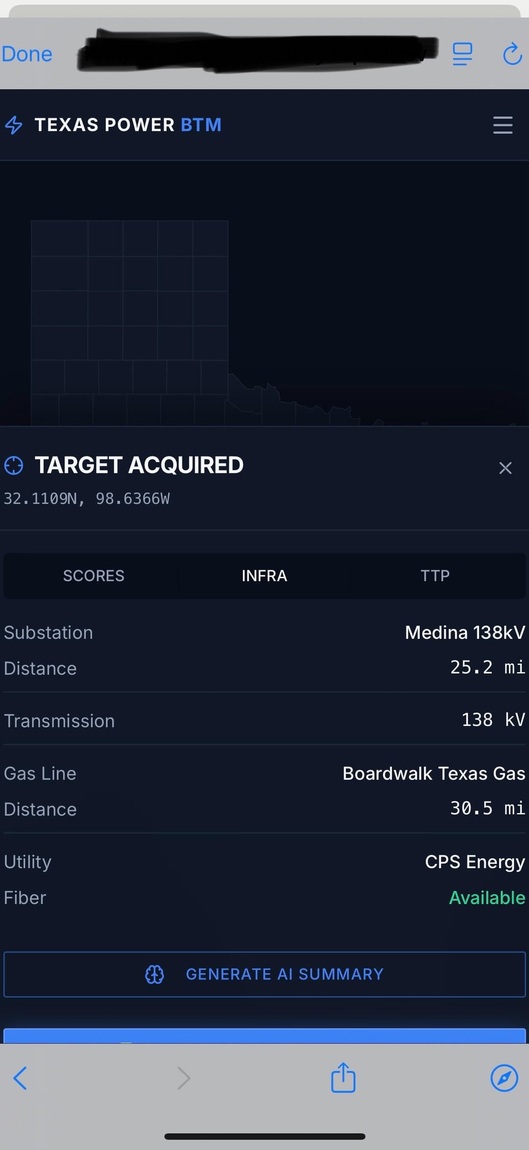
Building an early-stage tool mapping U.S. electricity availability + grid constraints for data center/industrial site selection. Looking for feedback from people in energy, utilities, GIS, or site selection on what’s useful vs missing. Screenshots attached. Prototype stage.
Source: Heavy_Window674
2 Comments
Do you have a web version?
Who is your intended customer and what are their use cases?
IMO too many players have already beaten you to the punch. National labs like NREL. Proprietary datasets like Cleanview. A litany of “grid interconnection” platforms for project prospecting. And the legacy tools for grid operators aren’t going anywhere anytime soon (eg, PSSE, TARA).
Nonetheless good luck with whichever path you choose to take